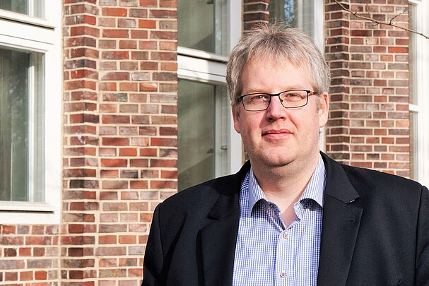
Professor of Engineering Geodesy and Geodetic Analysis Methods

30167 Hannover

Curriculum vitae
-
Professional career
since 2015
Executive Director of the Geodetic Institute at Leibniz University Hannover
since September 2012
Chair of Engineering Geodesy and Geodetic Data Analysis at the Geodetic Institute of Leibniz University Hannover
April 2009 - August 2012
Scientific Laboratory Manager for Geodesy at the University of the Federal Armed Forces Munich
15 May 2009 (day of doctorate)
Dissertation: On the modelling of an extended uncertainty budget in parameter estimation and hypothesis testing
February 2008 - March 2008
Research stay at the University of Texas at El Paso (USA) at the Department of Computer Science (Prof. Vladik Kreinovich)
April 2005 - March 2009
Research Assistant (DFG) at the Geodetic Institute of Leibniz University Hannover
September 2000 - March 2005
Studies in Geodesy and Geoinformatics at Leibniz University Hannover
15 December 1977
Born in Thedinghausen
-
Memberships and positions
- Member of the Standing Commission, German Faculty Association for Civil Engineering, Geodesy and Environmental Engineering (F.T.B.G.U.)
- Board member of ASBau - Association for the Accreditation of Degree Programmes in Civil Engineering
- Full member of the German Geodetic Commission (DGK)
- Head of DVW Working Group 4 - Engineering Geodesy and Measurement Technology
- Full member of the Society for the Calibration of Geodetic Measuring Instruments (GKGM)
- Member of the German Institute for Standardisation (DIN, NA 005-03-01 AA - Geodetic Instruments and Sensors)
- German delegate of DIN in ISO/TC 172/SC 6 - Geodetic and Surveying Instruments
- Association of German Surveyors (VDV) - University representative of LUH, member of the board of the Lower Saxony regional association
- Association for the Promotion of Geodesy and Geoinformatics at Leibniz University Hannover
-
Prizes and awards
- Award for outstanding student achievements at the University of Hanover (12 March 2003).
- Scholarship from the Victor Rizkallah Foundation for outstanding academic achievements (14 October 2005).
- Book prizes from the Department of Geodesy and Geoinformatics for special achievements in the degree programme and for special commitment to the student council (both on 14.01.2006).
- NSF-Fellowship for the 2nd NSF Workshop on Reliable Engineering Computing. Savannah (Georgia), USA (22-24 February 2006).
- Award of the Harbert Book Prize of the DVW (Deutscher Verein für Vermessungswesen, 13 June 2006).
- Invitation as visiting scientist to the University of Texas in El Paso (Department of Computer Science) by Prof. V. Kreinovich (28 June 2006, visit in 02/03 2008)
- NSF-Fellowship for the 3rd NSF Workshop on Reliable Engineering Computing. Savannah (Georgia), USA (20-22/02/2008).
- Best Poster Award at the 16th International Course on Engineering Surveying (26/02/2010).
- Best Paper Award "NAFIPS'17 (North American Fuzzy Information Processing Society)" (October 2017)
Courses
- Sensorik (B. Sc. Geodesy and Geoinformatics, M. Sc. Civil Engineering)
- Mess- und Rechenverfahren in der Ingenieurgeodäsie (B. Sc. Geodesy and Geoinformatics)
- Ingenieurgeodäsie (B. Sc. Geodesy and Geoinformatics, M. Sc. Civil Engineering)
- Industrial Surveying - Industrievermesseung (M. Sc. Geodesy and Geoinformatics, M. Sc. Mechatronics and Robotics)
- Kalibrierung von Multi-Sensor-Systemen (M. Sc. Geodesy and Geoinformatics, M. Sc. Mechatronics and Robotics)
- Ingenieurgeodäsie - Aktuelle Aspekte (M. Sc. Geodesy and Geoinformatics)
- Schätz- und Optimierungsverfahren (M. Sc. Geodesy and Geoinformatics, M. Sc. Mechatronics and Robotics, M. Sc. Civil Engineering)
- Digitale Technologien im Ingenieurwesen (B. Sc. Civil Engineering)


